Additional Trails
- Brevard Bike Path
- Jacksonville-Camp LeJeune Rail-to-Trails | Trail Map
- Kings Mountain Gateway Trail
- Louisburg-Franklinton Trail | Trail Map
- Mt. Mitchell Railroad Trails
- Railroad Grade Road
- Sabina Gould Walkway
List of Trails

Atlantic and Yadkin Greenway
Location: City of Greensboro and Guilford County
Distance / Length: 7.5 miles
Download Greensboro Trail Maps

Deep River Rail Trail
Location: Randolph
Distance / Length: Currently a bit less than 2 miles. Long term plans are to add up to 3 miles.
Download Trail Map
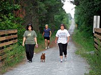
Dunn-Erwin Rail Trail
Location: Harnett County
Distance / Length: 5 miles - Walking, biking, no RTVs or horses (paved trail)
Download Trail Map

Eagle Spur Trail
Location: Triangle Area. Durham County. Right off of Stagecoach Rd. and less than a half mile down from Hwy 751
Distance / Length: 2.2 miles
Download Trail Map

Elkin and Alleghany Rail-Trail
Location: Elkin
Distance / Length: 15-mile climb (in progress) to the base of Stone Mountain
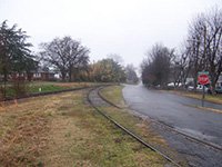
Forrest Hunt Greenway
Location: Rutherford County
Distance / Length: 0.8 miles, via bicycle: 30 minutes at a leisurely pace

Lansing Trail
Location: Lansing
Distance / Length: 0.5 miles on the former Virginia-Carolina rail bed
Download Trail Map

Laurel River Trail
Location: Western North Carolina. Madison County. Intersection of Hwy 25/70 and Hwy 208
Distance / Length: 3.6 miles
Download Trail Map

Little Tennessee River Greenway
Location: Franklin
Distance / Length: 4.5 asphalt-paved miles used for bicycling and hiking
Download Trail Map

Nantahala Bikeway
Location: Western North Carolina. Swain County. Alongside U.S. 19/ U.S.74, off of Wayah Rd.
Distance / Length: 1.2 miles / 0.5 paved trail
Download Trail Map

Roger Snyder and Rock Creek Park Greenways
Location: Abermarle
Distance / Length: Roger Snyder, 1.4 miles / Rock Creek, 1 mile
Download Trail Map

Thermal Belt Rail-Trail
Location: Rutherford County. Intersection of W. Main St. and Kentucky St. in Spindale
Distance / Length: 8 miles
Download Trail Map
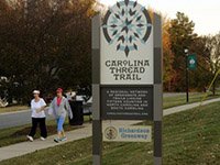
Troutman Rail-Trail
Location: Iredell County, between US 21 - NC115 / Main Street and Eastway Drive
Distance / Length: 1 mile


