Forrest Hunt Greenway
Overview
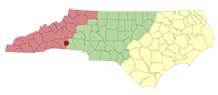
This 0.8 mile stretch of path is ideal for daily commuters to the Forrest Hunt Elementary School and also those wishing to take an easy and pleasant walk through the woods. Conveniently located near South Broadway Street, this trail is a fairly straight path that has travelers alternately treading on compacted dirt and compacted gravel. The trail is also located on relatively flat terrain, with the only significant rise occurring toward the end/beginning of the greenway near the Bechtler Development Corporation entrance on Schneider Drive. This greenway is a true asset to the community, and out-of-towners, looking for an enjoyable stroll through the neighborhood. Directions and Parking: The most accessible entrance to the trail is located off of the parking lot to the Forrest Hunt Elementary School. The entrance to the school is located directly off of South Broadway Street and is generally free from traffic on the weekends. The other entrance is located at the intersection of intersection of Heritage Avenue and Schneider Drive near the entrance to the manufacturing corporation. Directions for both entrances are found below: Forrest Hunt Elementary School: Take US-74 E (towards signs for Columbus/Rutherfordton/Carolina 108), Take exit 182 (for US-221) toward Forest City. Turn right onto South Broadway Street and the school will be on your right. The trail head is near the intersection of the driveway into the parking lot and South Broadway St. Bechtler Development Corporation: Take US-74 E (towards signs for Columbus/Rutherfordton/Carolina 108), Take exit 182 (for US-221) toward Forest City. Merge onto Pine St. and turn right at Heritage and Main Street. The entrance to the factory does provide some gravel parking, which should be available during the weekend hours; however, it was unclear if it was available for public use.
Trail Description
Whether on a bike, with a baby stroller, or running shoes, this trail delivers a fun alternative to the neighborhood stroll. If parking at the Forrest Hunt Elementary school, the trail access begins with a dirt path located near the entrance of the parking lot. As a subtle treat, roughly 500 feet into the hike, an old train truss (or bridge) has been converted into a pedestrian passage, giving one the sense of North Carolina rail history with its sturdy wooden ‘handrails’. However, be warned that the ‘step’ provided by the bridge is a little steep for your average biker and may necessitate a quick dismount! After crossing over, the trail becomes enclosed in tree cover, simultaneously protecting it from road-noise and creating more of a forest-type feel. As the trail progresses, there is another path that breaks off to the right, which is quite possibly a utility road-access that leads toward a hilly power-line corridor that has a single trail following the power-line towers. Continuing on the greenway, it soon opens up from underneath the tree cover and the local cemetery can be found on the right hand side, complete with a picnic table for those that would like to enjoy the open space and take a break under the huge oak and maple trees that dot the perimeter of the cemetery. While the trail does cross over a few neighborhood streets, they are generally not congested and provide ample sight lines for pedestrians to feel safe crossing over them. As the trail proceeds through the neighborhood, the street level and the path level diverge, creating a lower pocket-pathway for the trail that generates a sense of safety from vehicular traffic. Towards the end of the trail the manufacturing site of the Bechtler Development Corporation comes into view, and indeed, the trail ends at one of the entrances to the company gates. In fact, the trail stops at the beginning of the original railroad tracks! It is near the end of this trail that one would either opt to turn around and enjoy the trail again or have to travel up a slight embankment to reach the parking area for the corporation, located at the intersection of Heritage Avenue and Schneider Drive.
View area Attractions
Trail Photos
Trail Information

County: Rutherford County.
Length: 0.8 miles, via bicycle: 30 minutes at a leisurely pace
Uses allowed: Walking and biking
Trail surface: TBA
Helpful links: Town Website: “We are located in the foothills of the Blue Ridge and Smoky Mountains of North Carolina. Our town is very close to major cities but we have maintained that family atmosphere that is the heart of our community.”
Support NCRT

North Carolina Rail-Trails is a proud member of Earth Share of North Carolina. Look for us in your workplace giving campaign.


